Using geofencing to enhance your security risk assessment

How do you filter out unwanted data when diving into a specific region or area of operation? Here's how to use geofencing to put together an informed, effective security risk assessment.
Using the right tools for your risk assessment is essential – without seeing the right data, at the right time, crucial information can be missed that could lead to serious errors.
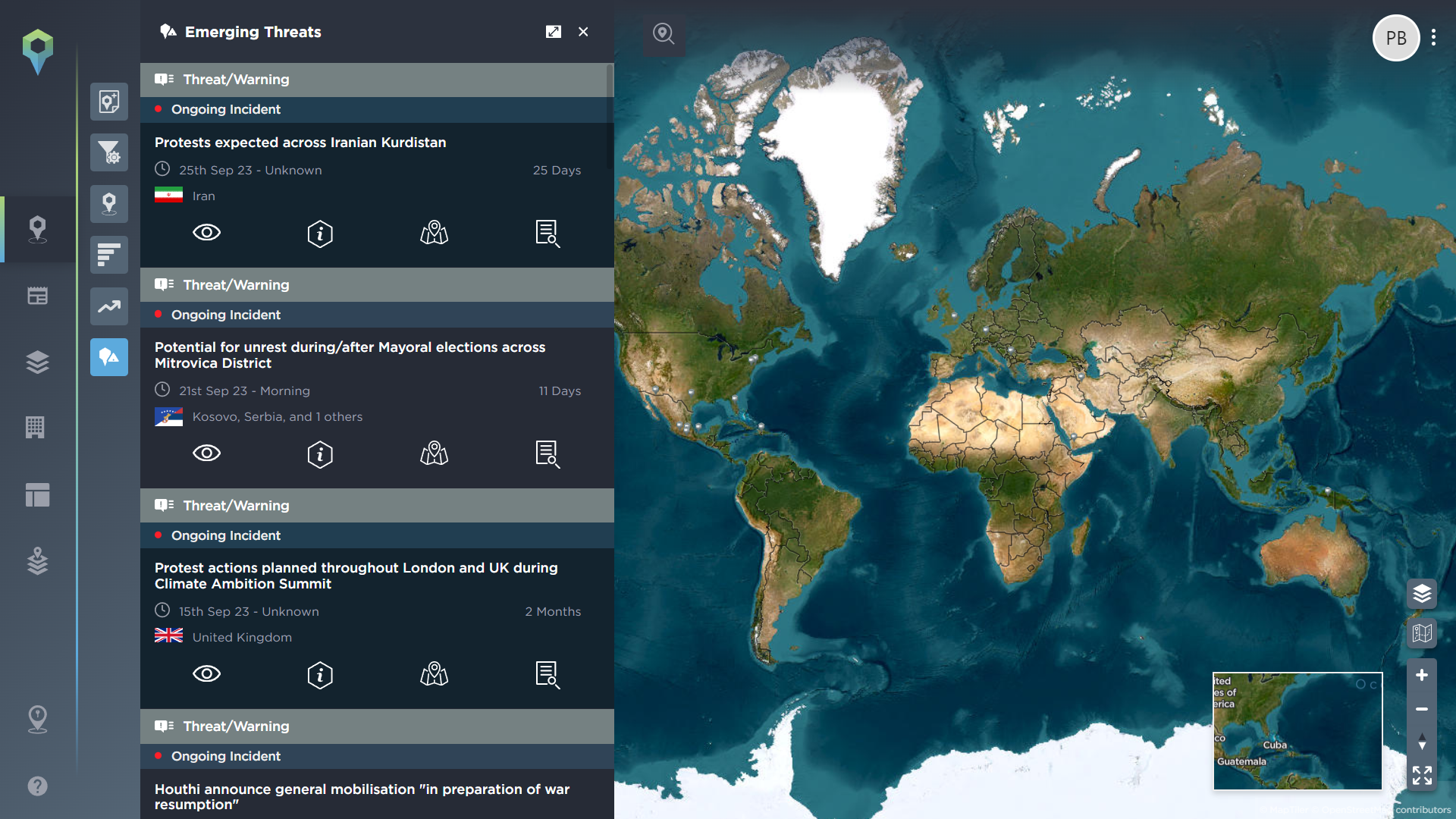
For many intelligence analysts, a key issue when conducting research ahead of a security risk assessment is being overwhelmed by too much information that is irrelevant to the task at hand. Finding a way to filter out unnecessary data – so that you can quickly understand the situation in the area you’re interested in, without missing vital information – is therefore an important part of your process.
At Intelligence Fusion, we recognise that many analysts will be conducting research on areas of operation that are highly specific, or that cross borders or regions, therefore making filtering at a country level too broad for what they need. This is why we allow users to get more granular with their search filters.
One of the most popular features of our risk management software is the ability to geofence a particular location, so that you only see the threat intelligence data related to that specific area. So how best to use this?
This article will explain how intelligence analysts can use geofencing to enhance their security risk assessments, by drilling down into the information that truly matters to their organisation, and operations. Here are just a few ways in which to use this highly flexible, but powerful filtering tool.
Geofencing for a travel risk assessment
Travelling for business regularly requires heading to large cities, whether because they’re global financial hubs, because they’re home to the headquarters of huge multinational companies, or because they’re hosting large industry events. Whatever the reason for travel, these cities often have their own unique risk profile, making it important to drill down into their specific threat intelligence data when preparing your travel risk assessment.
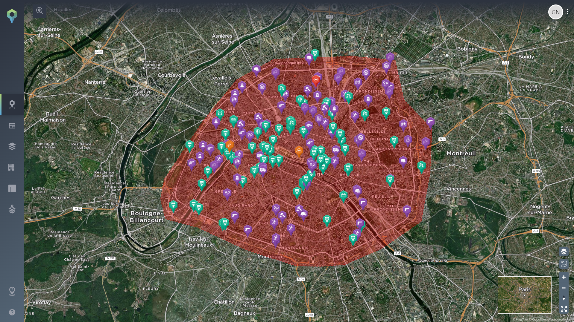
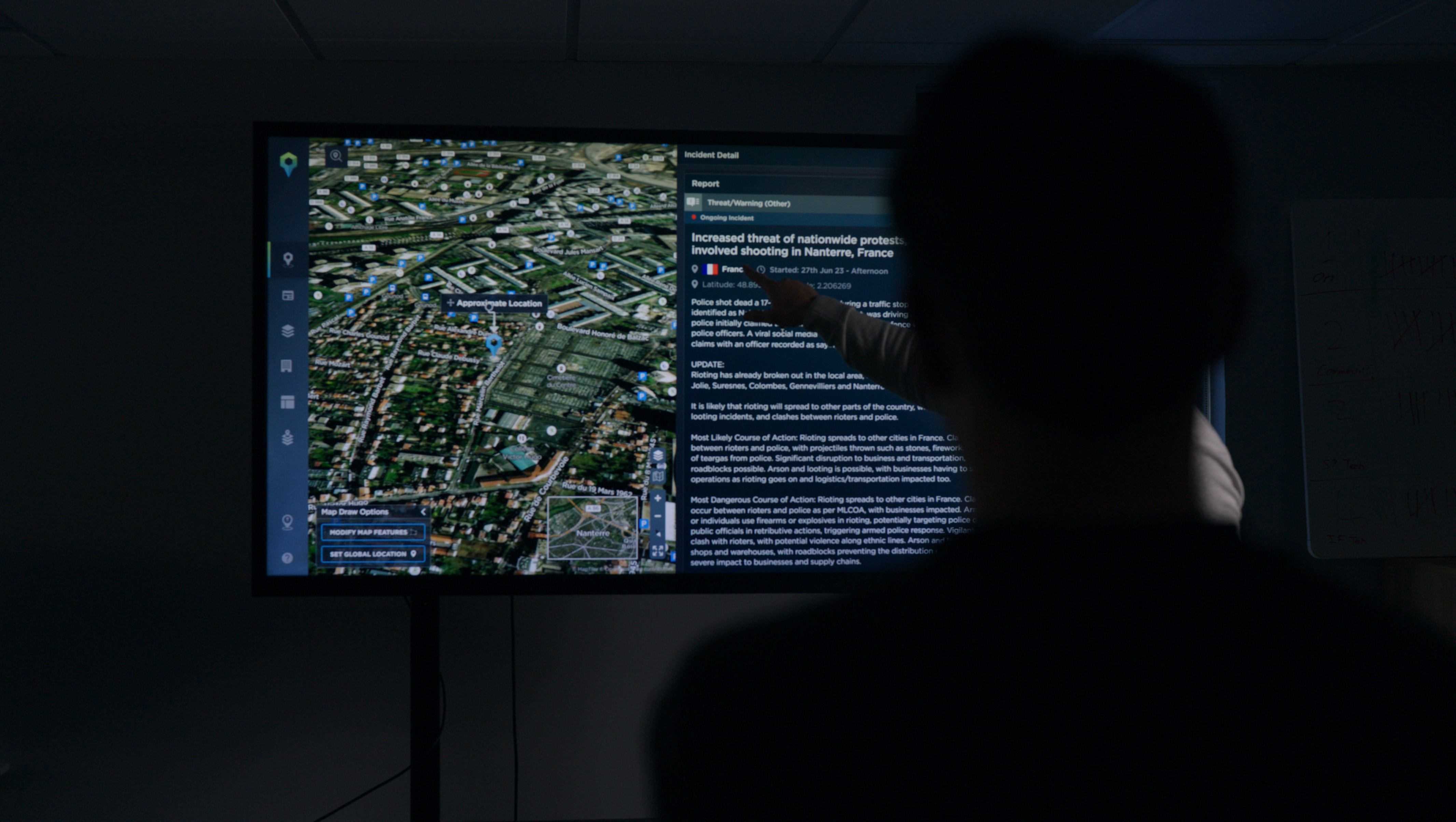
Image shows six months worth of incidents in an area geofenced around Paris, France [image source: Intelligence Fusion]
In this example, we’ve geofenced around the city limits of Paris. As you can see, there is regular protest activity in the city (green icons), often concentrated around certain locations or routes. Protests are often identified ahead of time, allowing you to take measures to avoid their impact on your business activity – but if not, you can still advise on how best to avoid their likely routes and any potential disruption based on their historic patterns of activity. Criminal activity (purple icons) is also something to be aware of for travellers – you can use this data to identify any areas of particularly high criminality for your employee to avoid or take particular precautions.
The geofencing tool can also be used in conjunction with any combination of other filters on our threat intelligence platform, allowing you to get even more granular with your reporting. For example, you might choose to focus on one or two types of incident that are of particular importance for your traveller – armed robbery for example.
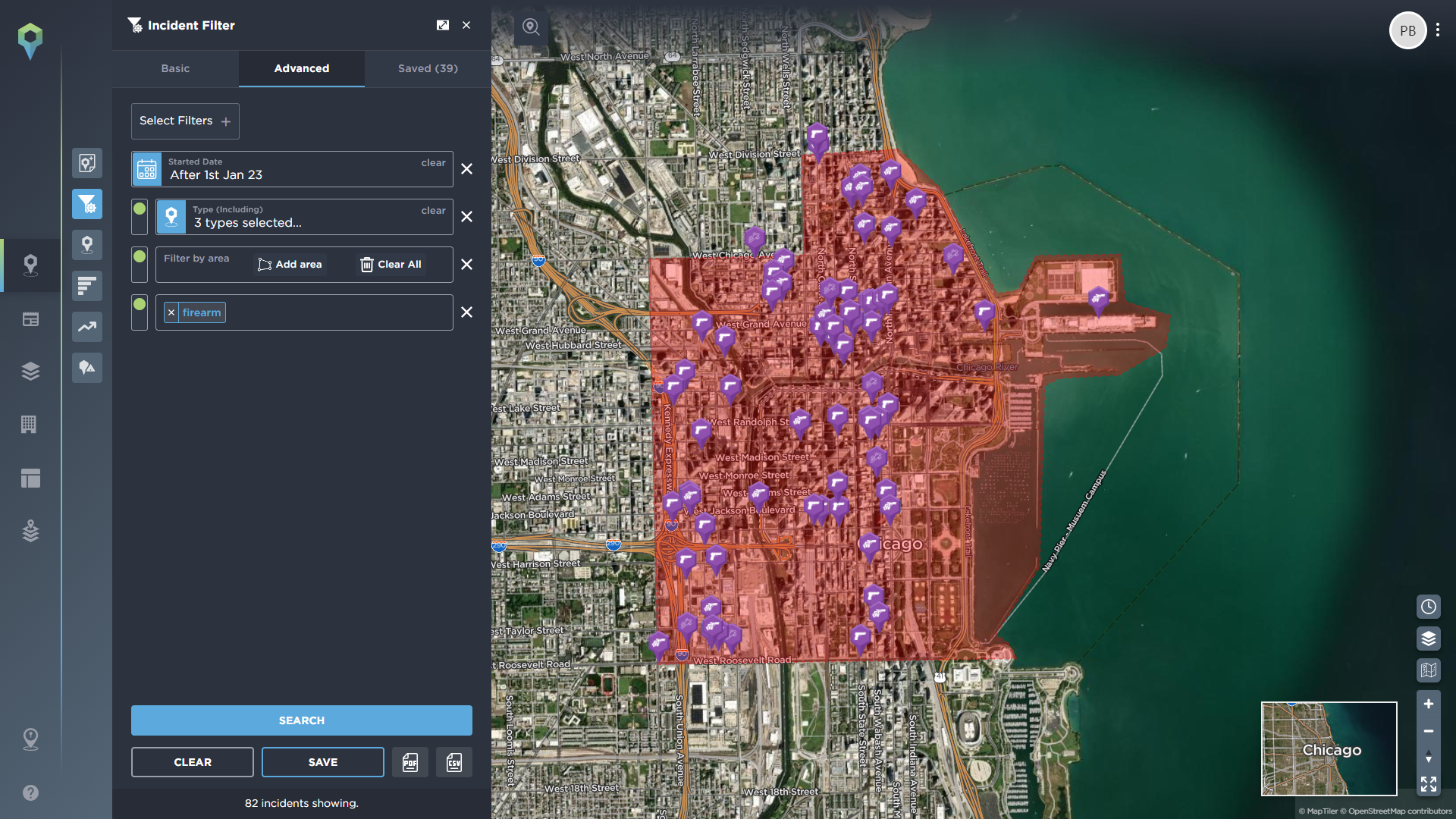
Image shows gun-crime related incidents in Chicago's CBD in the first three months of 2024 [image source: Intelligence Fusion]
In the example used here, we’ve gone even more granular than city-wide level, focusing on the Central Business District (CBD) of Chicago, and filtering to only include incidents of armed robbery, small arms fire, and murder in the area, which involved a firearm, over the past three months. This can then assist with assessing the level of threat to your employee from gun crime in the exact location they will be visiting.
Setting up new or reshoring operations
Ahead of any new operation or deployment, a thorough risk assessment is required. It is essential that you understand the threat landscape of the areas in which you will be operating.
While there are a number of tools that you can use within your risk management software to identify risk and put together a threat profile of a particular country or region, you still need to understand the situation within your specific proposed areas of operation. The geofencing tool allows you to do this quickly and effectively.
One use case could be for a new NGO mission or deployment. Often, these are at short notice, and in some of the most unstable regions in the world, making swift and effective risk assessment and mitigation measures particularly important. Geofencing can be useful in this instance for a number of reasons – for instance, areas of need can cross borders, so being able to hone in on the exact area that you are needed, regardless of which side of the border this is, helps you quickly understand the threats associated with that location. This can then be used in conjunction with the country profiles you might need to understand the different political and regulatory situations in each country, so you can get a holistic understanding of both the situation on the ground and in terms of the wider context on either side of the border. You could also geofence around your proposed field office sites, any towns or villages your workers may be deployed to to distribute aid or medicine, or routes between the two, among other examples.
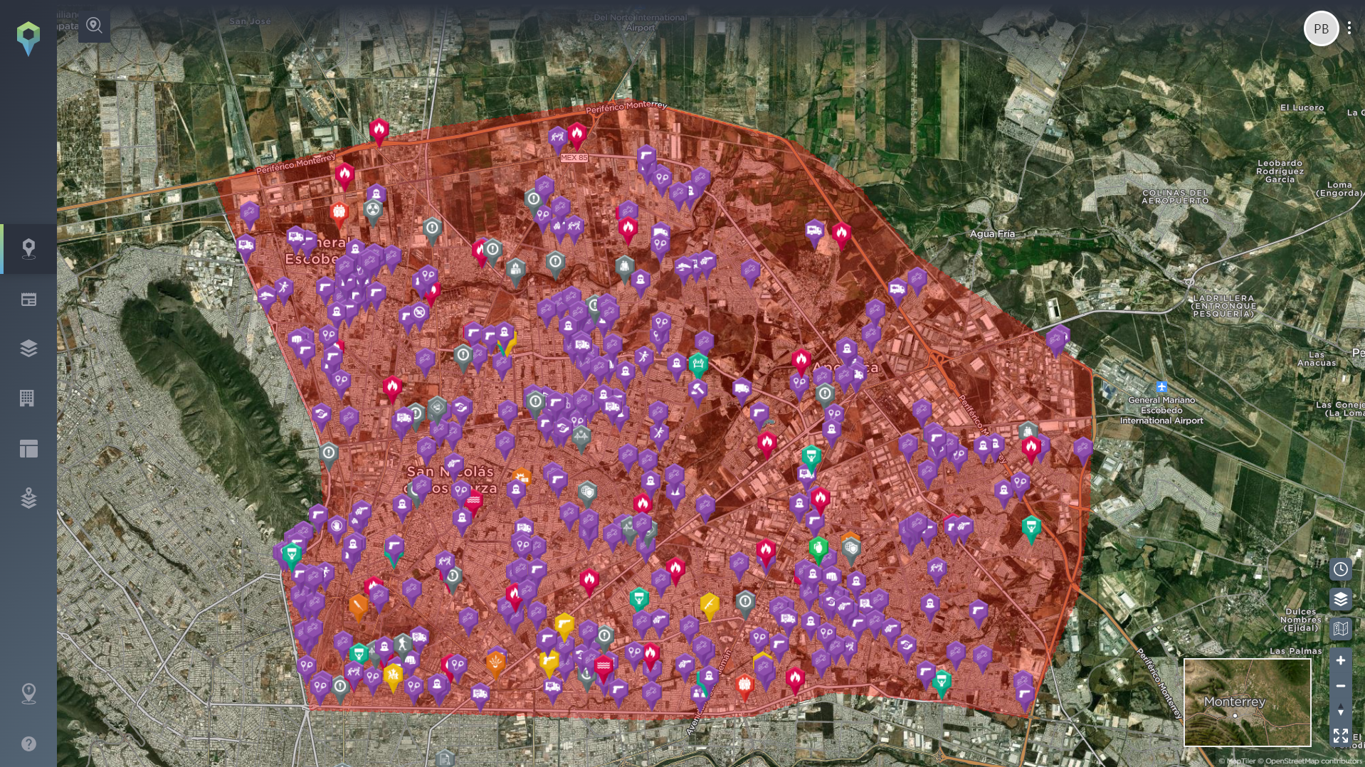
Image shows a geofenced area around Apodaca and Northern Monterrey, Mexico, home to a large number of manufacturing operations [image source: Intelligence Fusion]
Another example could be for reshoring your operations. Let’s say you are a manufacturing company, looking to reshore your operations to Monterrey, Mexico. Using the draw area tool you can geofence around your proposed operating site, instantly seeing the threats in the area, so you can understand the risks you will have to mitigate once operations begin.
You can then repeat this process along your supply chain, and how it could connect to your proposed site, visualising your risk at every stage – including along potential routes.
Geofencing for your route threat assessment
When you understand how to conduct an effective route threat assessment, it becomes a valuable asset that can help you and your security team understand, and therefore plan for, the potential threats your travellers may face.
An effective Route Threat Assessment will usually consist of the following:
- A map of the area
- The routes involved
- Any boundaries
- Social context including demographics, tribes, military, police etc.
- The circumstances for example intent, weather or anything else of note
By geofencing around any potential routes identified by the security team leader, the intelligence analyst can quickly drill down into the relevant historical incidents and threat intelligence data that relates to the brief.
For example, relating back to the NGO use case highlighted in the previous section, an analyst putting together a route threat assessment for a field visit can highlight the proposed route and quickly identify the possible threats the convoy would face, where the threat would be at its greatest, and assess the likelihood and impact of any potential attack or other threat.
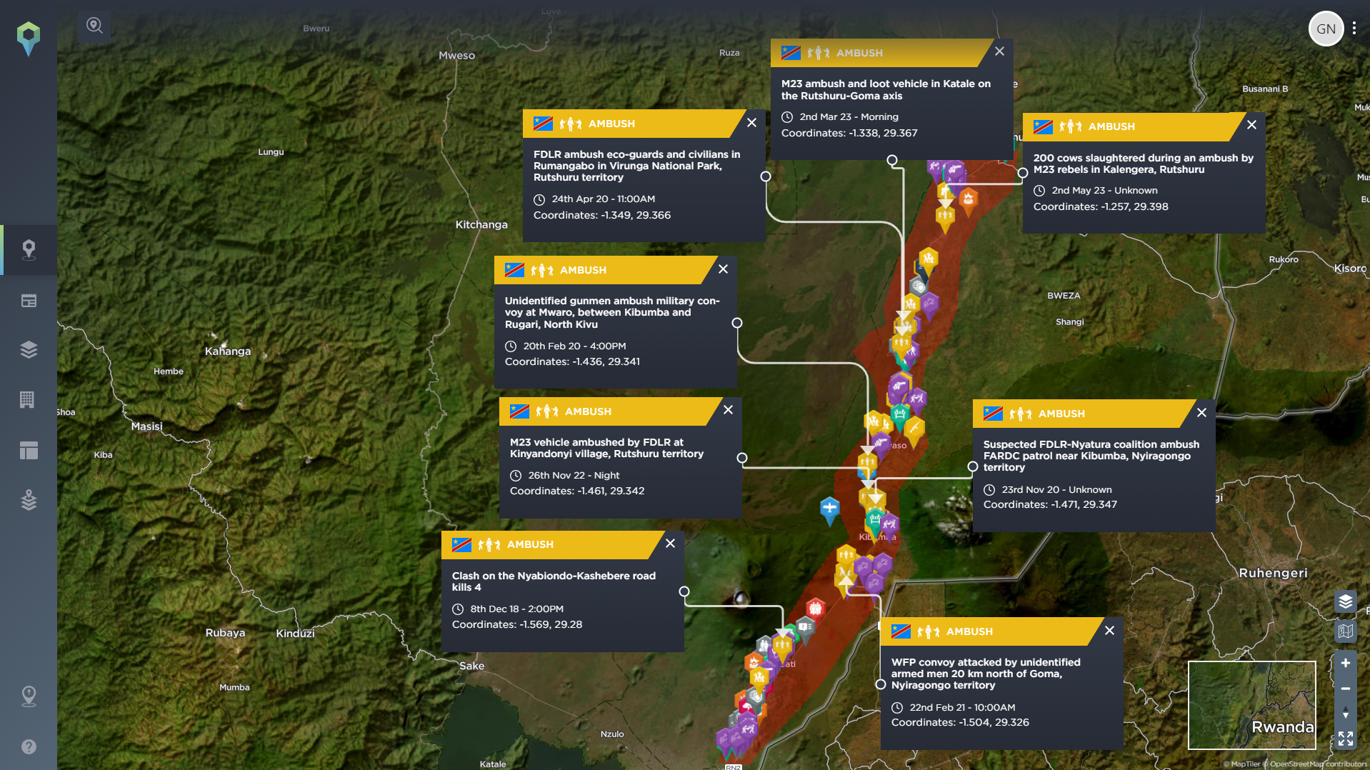
Image shows a geofenced area around a proposed route between Goma and Rutshuru, North Kivu, DRC [image source: Intelligence Fusion]
The example above shows the route from Goma, the capital of North Kivu Province, DRC, and Rutshuru, a town 70km to the north. By geofencing around the road, National Route 2 in this case, an intelligence analyst can see that, among other historical incidents displayed, there is a history of ambush attacks along the route. This can help inform the route threat assessment and advise on any risk mitigation efforts necessary for the journey.
A similar thing can be done with the manufacturing use case. By highlighting the routes taken between one part of the supply chain and the next, logistics companies can become better informed about the risks facing their delivery, for instance armed robbery and hijackings, or hazards such as landslides. This can then be used in conjunction with other data such as weather reports or traffic patterns to form a more comprehensive threat analysis.
This article is not an exhaustive list of all the ways in which you can use geofencing to enhance your risk assessment – they are just three of a whole host of ways you can use our draw area tool.
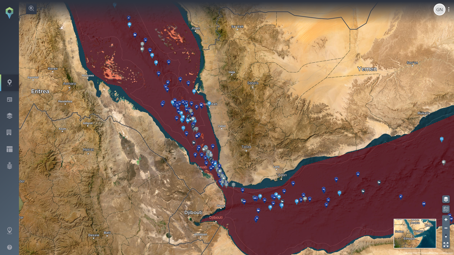
Image shows a geofenced area of the Red Sea, Bab al Mandeb strait and Gulf of Aden [image source: Intelligence Fusion]
From maritime security to border analysis, there are a wide range of additional use cases for geofencing – for instance, above we’ve geofenced an area of the Red Sea, Bab al Mandeb Strait and Gulf Aden, which could be used to assess the threat posed by the ongoing Houthi attacks on shipping. This would allow the user to quickly see any incidents mapped in the region that may be in the territorial waters of Yemen, Djibouti, Somalia, Eritrea, in international waters, or anywhere else, without having to filter for all of these locations, and therefore being inundated with incidents elsewhere that are irrelevant to your interests.
If you’d like to learn more about geofencing for security and risk analysis, or to better understand how to use the draw area tool on the Intelligence Fusion platform, we’ve put together a recorded demonstration of how you can use geofencing in the platform in more detail.
About the author